
Globes and maps are both cartographic tools used to represent the Earth’s surface, but they differ in their form and purpose. A globe is the true model of the earth with true shapes and size on the areas. A map is the drawing of the earth as whole or a part of it on a flat surface. Here’s an overview of each showing the major
difference between globes and maps
Globes:
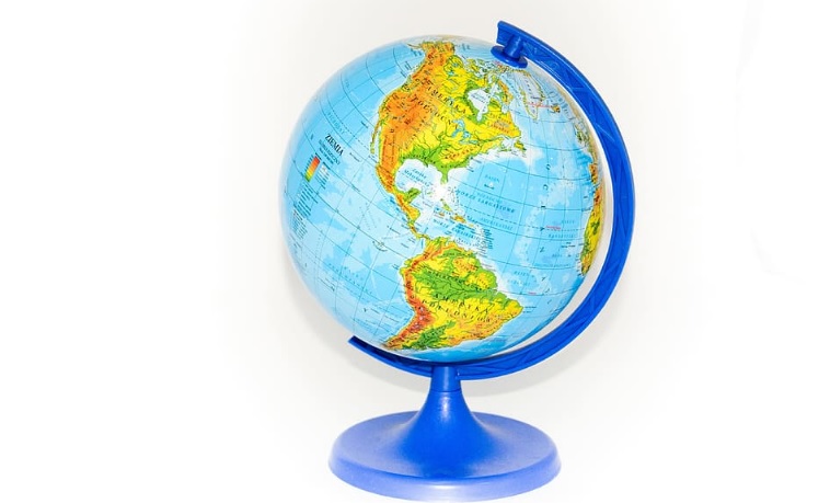
A globe can show us the whole earth at one glance accurately .It is the spherical model of earth. Globes serve purposes similar to maps, but unlike maps, they do not distort the surface that they portray except to scale it down. A model globe of Earth is called a terrestrial globe. A model globe of the celestial sphere is called a celestial globe. The globe shows continents and oceans in their true shape and size.
3D Representation: A globe is a three-dimensional spherical representation of the Earth. It provides a more accurate depiction of the Earth’s shape and the spatial relationships between continents, oceans, and other geographical features.
Scale Accuracy: Globes maintain a consistent scale across their entire surface, making them more accurate in terms of proportions and distances compared to maps, especially in representing features near the poles.
Global Perspective: Globes offer a comprehensive and continuous view of the entire Earth, allowing users to observe how different regions relate to one another in terms of distance and direction.
Use in Education: Globes are commonly used in educational settings to help students understand the Earth’s geography, latitude and longitude, and the concept of hemispheres.
Limitations: Despite their accuracy, globes are not as practical for detailed local or regional information, and they are not easily portable.
Maps:
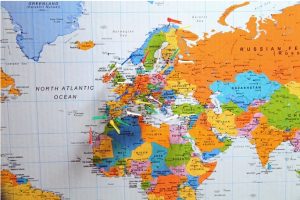
A map is a drawing Earth’s surface. Its basic motive is to show where things are. Maps can show visible features like rivers and lakes, forests, buildings, and roads. They may also show things that cannot be seen, such as political boundaries and temperatures. Most of the maps are drawn on a flat surface. A map displayed on a round surface is called a globe.it can also be used to study maps showing a large variety of geographical , historical and other information.
2D Representation: Maps are two-dimensional representations of the Earth’s surface. They can be presented in various projections, each having its strengths and distortions.
Varied Scales: Maps allow for the representation of specific areas or themes, and they can use different scales to provide detailed information for a particular region.
Portability: Maps are highly portable and can be easily folded or rolled, making them practical for navigation, travel, and fieldwork.
Specialized Information: Maps can be customized to display specific information such as topography, political boundaries, climate, and more. There are thematic maps designed for specific purposes.
Digital Formats: In the modern era, maps are often available in digital formats, accessible through computers, smartphones, and other electronic devices.
Limitations: Maps, especially those in certain projections, can introduce distortions in terms of shape, area, distance, or direction, depending on the map’s purpose and design.
Both globes and maps serve important roles in understanding and representing the Earth’s geography. The choice between them depends on the specific needs and preferences of the user, as well as the context in which they are used.
difference between globes and maps
Image source https://www.wallpaperflare.com/
https://www.rawpixel.com/
faq :
1.what are globes and maps?
ans:- Globes and maps are both cartographic tools used to represent the Earth’s surface, but they differ in their form and purpose. A globe is the true model of the earth with true shapes and size on the areas. A map is the drawing of the earth as whole or a part of it on a flat surface.
2.How do you teach globes and maps?
ans:-
- define the equator and the poles ans also the hemisphere.
- define what is globe.?
- identify sources of land and water on a globe,
- locate the equator and the poles on a map and globe,
- identify the Northern and Southern Hemispheres on a map and a globe